Greg Cocks
@kiwiincolorado.bsky.social
Personal Account, All Views My Own | Spatial Data Scientist/Researcher | #spatial #GIS #water #hydrology #AllDataIsSpatial #KiwiInColorado #DataIsPlural


I generated a word cloud from my (extended) résumé + project writeups, it was interesting to see what popped out...
#GIS #spatial #mapping #wordcloud #resume #projects #professionalhistory

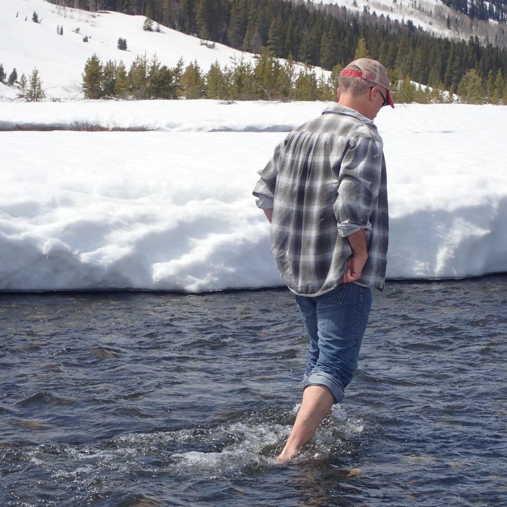
A change of scenery can revitalise the learning processes some...
#GIS #spatial #mapping #learning #python #continuingeducation #selflearning #review #opensource #shiba #shibsinu

A change of scenery can revitalise the learning processes some...
#GIS #spatial #mapping #learning #python #continuingeducation #selflearning #review #opensource
Research Reveals That Prehistoric #Seafloor #Pockmarks Off The #California #Coast Are Maintained By Powerful #Sediment #Flows
-
phys.org/news/2024-05...
-
#GIS #spatial #mapping #remotesensing #bathymetry #geomorphometry #geomorphology #geology #infrastructure #windfarms #risk #hazard #AUV


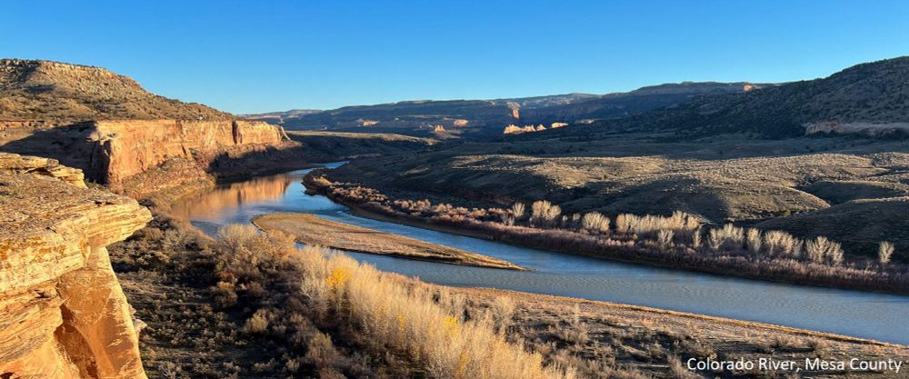
#Declining #Groundwater #Storage Expected Amplify #Mountain #Streamflow Reductions In #Warmer #World
-
www.nature.com/articles/s44...
-
#GIS #spatial #mapping #ColoradoRiver #streamflow #climatechange #hydrology #water #model #snowmelt #recharge #waterresources #headwaters #mountain #spatialanalysis


#ExtremeWeather #Maps - Track the #Risks for Your [#USA] Places
-
www.nytimes.com/interactive/...
-
#GIS #spatial #mapping #weather #risk #hazard #publicsafety #forecasting #resource #NationalWeatherService #yellow #orange #red #prediction #notifaction
@nytimes.com @NWSSPC @nwstornado.bsky.social


#30DaysOfQGIS – Master QGIS in 30 Days
-
spatialthoughts.com/2024/05/13/3...
-
#GIS #spatial #mapping #training #onlinelearning #onlinetraining #continuingeducation #tutorials #opensource #QGIS #software #free #freetraining #gissoftware #onlinevideos #videotraining #elearning
@SpatialThoughts


UAV [aka ‘Drone’] Surveying At The UK’s Ordnance Survey #podcast
-
thegeomob.com/podcast/epis...
-
www.ordnancesurvey.co.uk/blog/how-sur...
-
#GIS #spatial #mapping #OSRapidMapping #engineeringgeology #remotsesensing #UAV #drone #survey #UK #England #UAS #aerial #usecase #efficiency
@OrdnanceSurvey


Reevaluating The #Elevations Of #Colorado #Mountain Summits Using Modern #Geodetic Techniques
-
doi.org/10.1007/s001...
-
#GIS #spatial #mapping #NAVD88 #NAPGD2022 #Fourteeners #3dep #geoid #mountains #mountain #orthometric #modeling #3dmodeling #LiDAR #ellipsoidal #gravity #geopotential
@USGS @NGS


#RemoteSensing #Coccolithophore #Blooms In Selected #Oceanic Regions Using The #PhytoDOAS Method Applied #HyperSpectral #Satellite #Data
-
doi.org/10.5194/bg-9...
-
#GIS #spatial #mapping #marine #ocean #earthobservation #ENVISAT #phytoplankton #plankton #biomass #spatialanalysis #spatiotemporal


Sad to hear that #Post social media site is closing down on May 31st, I enjoy and think it is worthwhile to post there, I like their formatting options and GUI, and appreciate the 'non shouty' community...
#socialmedia #loss #Post #closing

#Hikurangi #SubductionZone - The Burning Question About #NZ’s Biggest #Earthquake-Maker
-
tinyurl.com/4b8yv9ba
-
#GIS #spatial #mapping #NewZealand #remotesensing #geophysics #faulting #subduction #platetectonics #risk #hazard #Raukumara #stress #margin #geology #model #testing #slowslip#SSE #mantle


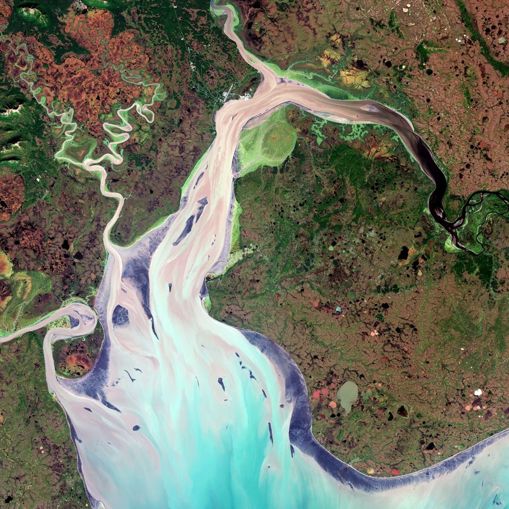
#LakeWanaka Mapped In Exquisite Detail
-
niwa.co.nz/news/lake-wa...
-
#GIS #spatial #hydrospatial #bathymetry #remotesensing #Wanaka #NewZealand #topobathy #lake #survey #geology #faulting #lakebed #glacial #multibeam #echosounder #waterquality #nutrients #sediment #climatechange #modeling
@niwa_nz


Joe Davies - #Data #Visualization & GIS At #Eurostat. Exploring New Ways Of #MapMaking
-
observablehq.com/@joewdavies
-
[not considered a specific endorsement]
#GIS #spatial #mapping #cartography #usecase #appliedscience #automation #code #api #webapps #spatialanalysis
@joewdavies.bsky.social


#Egyptian #Pyramid Chain Was Built Along The Now-#Abandoned #Ahramat #Nile #Branch
-
doi.org/10.1038/s432...
-
#GIS #spatial #mapping #Egypt #pyramids #NileRiver #water #hydrology #archaeology #AncientEgypt #radar #remotesensing #earthobservation #EO #geophysics #GPR #NileValley #construction #river


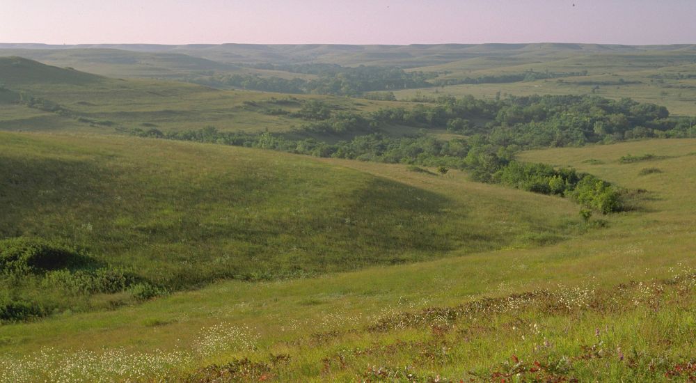
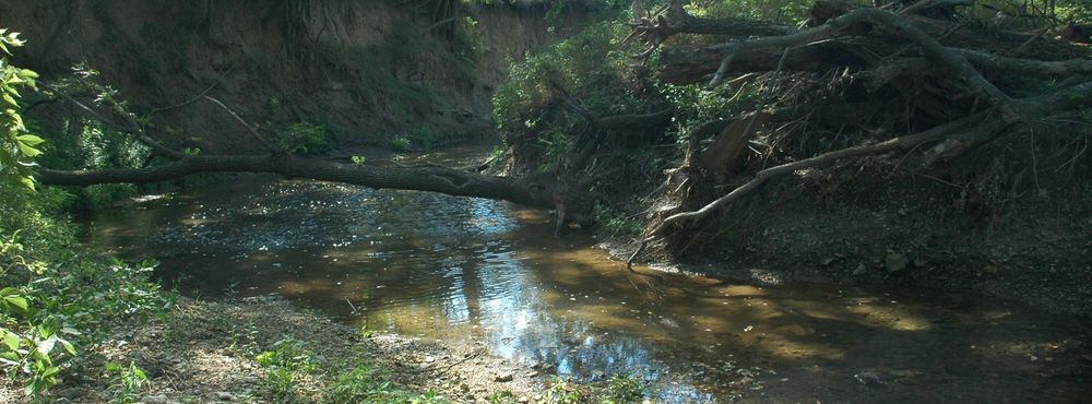
Trajectories And State Changes Of A #Grassland #Stream & #Riparian #Zone After A Decade Of #Woody #Vegetation Removal
-
doi.org/10.1002/eap....
-
#GIS #spatial #mapping #nutrients #waterquality #Kansas #prairie #water #hydrology #landuse #climatechange #streambed #ecosystem #sediment #biomes #NEON


Finding Space for #Tigers
-
tinyurl.com/yc2chbc4
-
#GIS #spatial #mapping #remotesensing #earthobservation #tiger #humanimpacts #wildlife #habitat #ecosystems #asia #ecology #habitatloss #conservation #modeling #spatialanalysis #spatiotemporal #protection #survey #sustainability
@NASA @NASAEarth


Time to dip into Tripp Corbin, GISP's latest tome...
--
www.amazon.com/ArcGIS-Pro-3...
--
Review to follow soon, if you were curious...
#GIS #spatial #mapping #ArcGIS #ArcGISPro #continuingeducation #education #professionaldevelopment #neverstoplearning #training #learning #gischat #packtpublishing


[#State Of] #Colorado To #Shield Thousands Of Acres Of #Wetlands, Miles Of #Streams [After #Federal #SupremeCourt #Sackett Decision]
-
tinyurl.com/mrysaby2
-
#water #hydrology #waterquality #waterresources #watersecurity #USWest #staterights #protection #CleanWaterAct #permitting #climatechange

The #Craton Enigma - Scientists Propose a New #Continental #Formation Theory
-
tinyurl.com/4pypzb6x
-
doi.org/10.1038/s415...
-
#GIS #spatial #mapping #geology #structuralgeology #cratons #planetary #evolution #platetectonics #earth #structure #weathering #erosion #water #Archaean #lithosphere


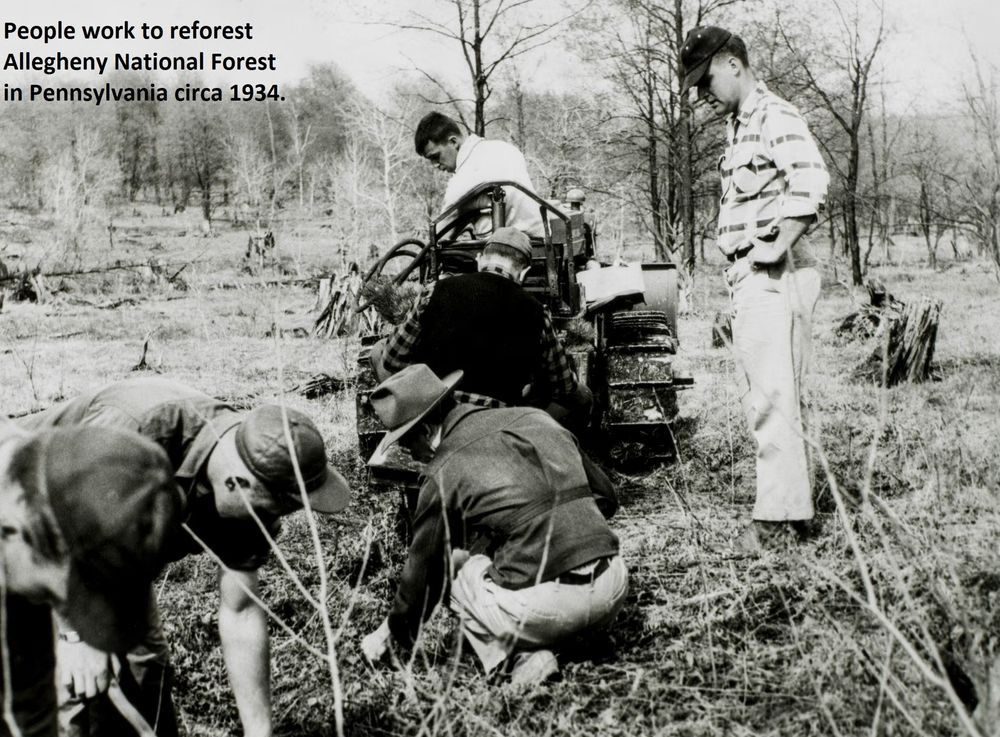
#Trees Stalling Effects Of Global #Heating In Eastern #USA
-
tinyurl.com/586ryr4c
-
#GIS #spatial #mapping #US #trees #reforestation #deforestation #planting #climatechange #warming #spatialanalysis #forests #cooling #climate #biophysical #airtemperature #albedo #remotesensing #earthobservation


#Archaeological #Investigation and #Hazard #Assessment Using #Magnetic, Ground-Penetrating #Radar, and #GPS Tools at #Dahshour Area, #Giza, #Egypt
-
doi.org/10.3389/fear...
-
#GIS #spatial #mapping #remotesensing #GPR #fieldwork #archaeology #survey #magneticsurvey #geophysics #earthquake #damage


Increasing #Fault #SlipRates Within The #CorinthRift, #Greece - A Rapidly Localising #Active #RiftFault Network
-
doi.org/10.1016/j.ep...
-
#GIS #spatial #mapping #geology #structuralgeology #Seismichazard #seismic #stratigraphy #earthquake #IODP #spatiotemporal #model #modeling #risk #hazard


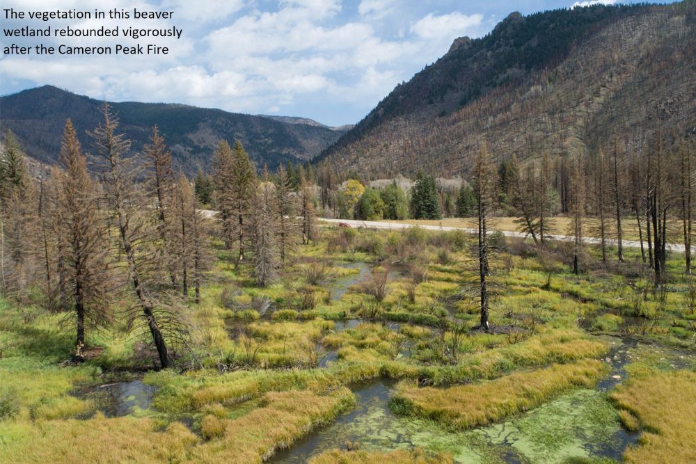
#Arctic #Rivers Face Big #Changes With #Warming #Climate, #Permafrost #Thaw & Accelerating #WaterCycle
-
tinyurl.com/f7kv6uhx
-
#GIS #spatial #mapping #model #modeling #water #hydrology #climatechange #sedimentation #rainfall #melting #riverflow #environment #coastal #drainage #runoff #erosion


Researchers Reconstruct #Landscapes That Greeted The First #Humans In #Australia ~65K Yrs Ago
phys.org/news/2024-04...
#GIS #spatial #mapping #anthropology #archaeology #indigenous #migration #sahul #Australia #aboriginal #spatiotemporal #sealevel #landscape #evolution #climatechange #physiography


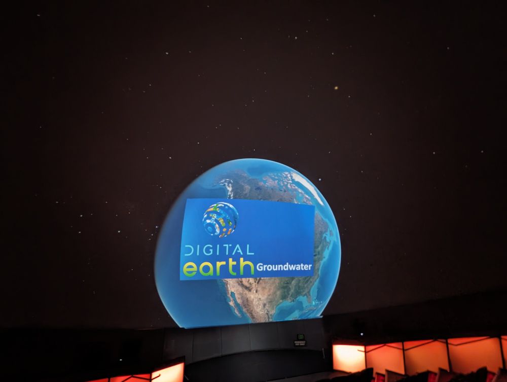
#Presentation - #DigitalEarth - #Groundwater, #Colorado’s Hidden Treasure - @DenverMuseumNS
-
www.dmns.org/visit/events...
-
#GIS #spatial #mapping #visualisation #storytelling #waterresources #water #hydrology #usecase #appliedscience #watersecurity #irrigation #climatechange #farming #agriculture


How 'Earth's Twin' Venus Lost Its Water And Became A Hellish Planet
--
www.space.com/venus-water-...
--
#GIS #spatial #mapping #modeling #model #water #hydrology #Venus #planet #extraterrestrial #astrogeology #astrohydrology #computermodeling #geochemistry #chemistry #atmosphere #molecule #HCO+


Mastering #GDAL Tools
-
www.youtube.com/playlist?lis...
-
#GIS #spatial #mapping #opensource #GDAL #raster #vector #library #OGR #tutorial #class #tutorials #onlinelearning #continuingeducation #Onlineclass #onlineclasses #qgis #anaconda #coding #scripting #elearning #learning
@spatialthoughts


#Polar Region #Bathymetry, Critical Knowledge For The Prediction Of #Global #SeaLevelRise
-
tinyurl.com/4ub6cb4w
-
#GIS #spatial #mapping #remotesensing #hydrography #hydrospatial #ocean #marine #model #modeling #seafloor #geomorphometry #SLR #sealevel #climatechange #spatialanalysis #spatiotemporal


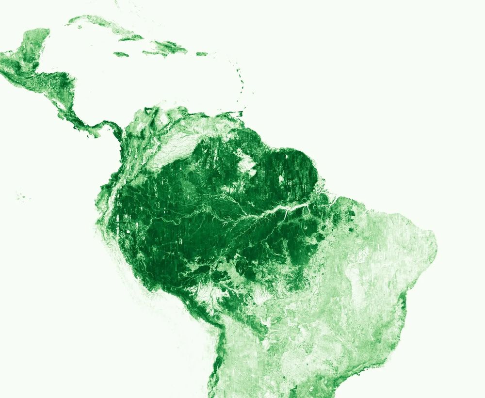
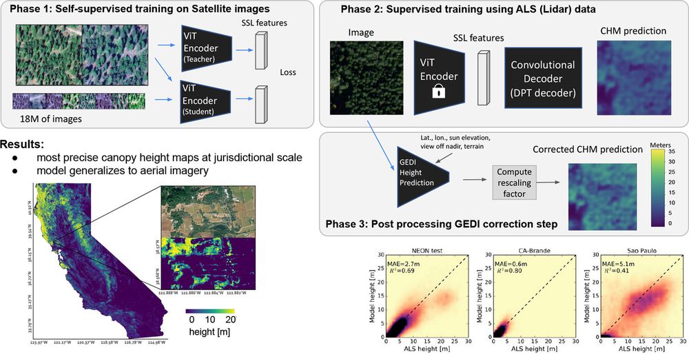
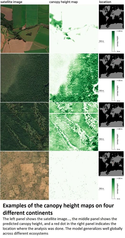
Using #ArtificialIntelligence To #Map The #Earth’s #Forests
-
tinyurl.com/y9zt8hyx
-
#GIS #spatial #AI #forestmonitoring #climatechange #forests #forestmanagement #global #spatialanalysis #LiDAR #remotesensing #earthobservation #model #modeling
@meta @World Resources Institute @Land & Carbon Lab

Over A Decade Of #Atmospheric #Mercury #Monitoring At #AmsterdamIsland French Southern & #Antarctica Lands
-
tinyurl.com/54exzwm8
-
#GIS #spatial #mapping #Hg #anthropogenic #environmental #levels #atmosphere #SouthernHemisphere #data #opendata #airpollution #pollution #publichealth #model #modeling


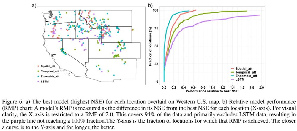
Improved #AI Process Could Better #Predict #Water Supplies
-
www.sciencedaily.com/releases/202...
-
#GIS #spatial #mapping #hydrology #waterresources #spatialanalysis #spatiotemporal #model #modeling #computermodel #snowpack #WesternUSA #USWest #watersecurity #prediction #SWE #decisions #SNOTEL


I also love this image from 1921 (!), still useful today, and when I used to teach a little it was part of my coursework… we are so visual…
(Deetz, Elements of Map Projection...)
#GIS #spatial #mapping #map #mapprojections #geography #coordinates #film #video #education #training #onlinelearning

The Impossible Map [video, 1947]
-
www.nfb.ca/film/impossi... <--link to video
-
#GIS #spatial #mapping #map #mapprojections #geography #coordinates #film #video #education #training #onlinelearning
@National Film Board of Canada @thenfb

The Impossible Map
Development in long-range travel and the growing importance of the Arctic and Antarctic regions make it …
www.nfb.ca