#cropland
#AgriTech #USGS #LiDAR
-
github.com/Jeremy-Tesh/...
-
#GIS #spatial #mapping #remotesensing #3dep #water #hydrology #farming #crops #cropland #maize #appliedscience #usecase #elevation #crophealth #irrigation #model #modeling #overlandflow #coding #python #spatialanalysis #opendata #opensource
@USGS


#Geospatial #Technology Can Help #Corn #Producers #Assess Potential #WindDamage
-
tinyurl.com/y3hh6z59
-
#GIS #spatial #mapping #remotesensing #wind #extremeweather #climatechange #agriculture #crops #cropland #risk #hazard #GPS #USA #yield #monitoring #greensnap #brittlesnap #USDA
@usda.bsky.social


#FoodTwin - Interactive #Map Shows Where Your #Food Comes From
-
tinyurl.com/y6f5t4hw
-
#GIS #spatial #mapping #digitaltwin #agriculture #spatialanalysis #USA #producer #consumer #farming #foodsecurity #logistics #infrastructure #crops #cropland #network #FarmToFork #farmtotable


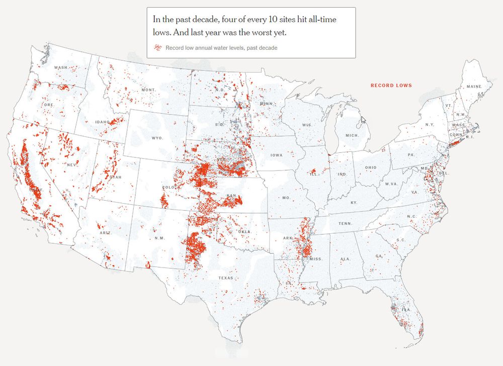
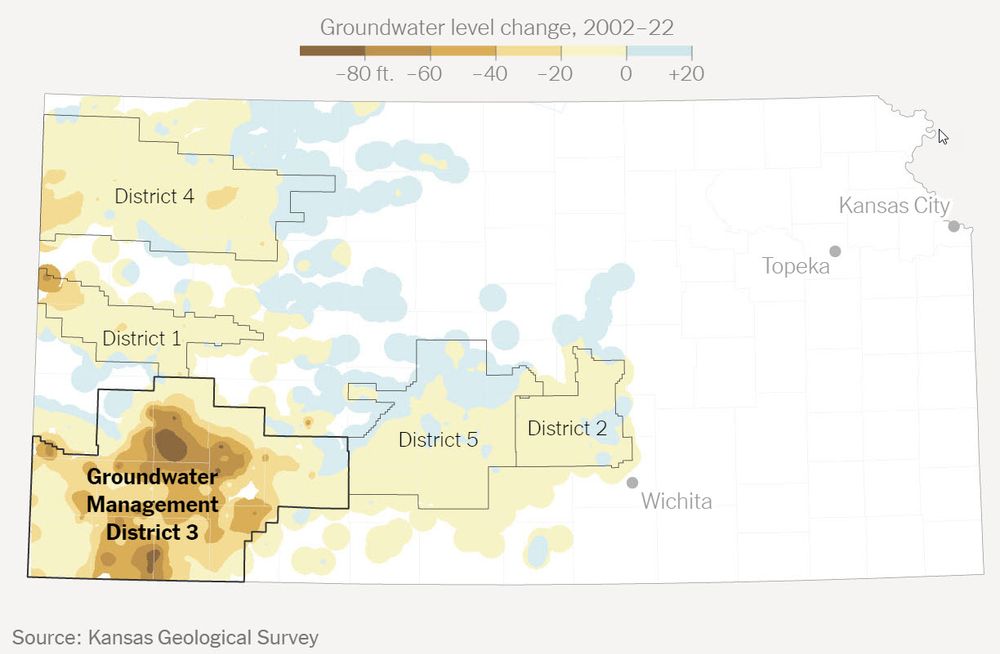
As #Groundwater Dwindles, Powerful Players Block Change
-
tinyurl.com/a9987a93
-
#GIS #spatial #mapping #USA #hydrology #hydrogeology #aquifer #farming #mining #agriculture #cropland #realestate #industry #heavyindustry #climatechange #waterresources #watermanagement #watersecurity #overpumping